We are incredibly blessed when it comes to hiking trails in Los Angeles. Whether you want to be in a forest-type setting, hike to a famous landmark, or have a view of the ocean, you can find a trail to peak your interests. There is also a great variety of hikes for all skill levels. I am constantly finding out about different trails so I hope this list will continue to grow and serve as a guide to help you find a new trail to explore.
On the LA Dreaming Podcast, I interviewed journalist Ellie Rudy. I discovered Ellie through an article that she wrote for LA Magazine on the 10 Best Hikes in LA. You can follow Ellie on Instagram and Twitter. We discussed seven different hiking areas in LA County on the podcast. You can listen to the podcast through Apple Podcasts, Spotify, Google Podcasts, Amazon Music, iHeartRadio, Stitcher, or Podbean.
Ellie mentioned that she loves using AllTrails when preparing for a hike. I have used this app before myself and find it incredibly helpful. When it comes to discovering hiking locations, I tend to get my inspiration from Instagram, Tiktok, and Pinterest. However, important information is not always included on social media so whenever I am prepping I do like finding out as much as possible so I can manage my expectations and try to set my hike up for success.
Hiking Trails in Los Angeles
The following hiking trails are the ones I discussed with Ellie on the podcast. I will follow this list up with other hiking trails that I have tried out myself.
Malibu Creek State Park
View this post on Instagram
Park Hours: 8 am – 10 pm
Dogs: Dogs are allowed on paved roads but not on trails.
Parking: 1 hour ($3) 2 hours ($6) 3 hours ($9) All day ($12)
There are two ways to pay for parking. You can pay at a machine that I believe only accepts cards, or you can pay via the Yodel app.
Bathrooms: There are real bathrooms.
There are several trails that you have to choose from at Malibu Creek State Park. Two of the easier trails and hikes are Rock Pool and Century Lake while the M*A*S*H site and Lookout Trail are considered moderate. The M*A*S*H hike has been on my to list for a long time, so I hope to visit and experience this one myself soon. There are so many trails that you can enjoy here that it’s too many to list.
If you would like to hike in this area I would go to the Alltrails app and search Malibu Creek State Park. You will see several options appear and it will show you the distance and approximate time it would take to complete that trail.
Santa Monica Mountains National Recreation Area
View this post on Instagram
Park Hours: 8 am – Sunset
Dogs: Dog Friendly
Parking: There is no entrance or parking fee unless you are camping.
Bathrooms: There are bathrooms available.
There are more than 500 miles of trails in the Santa Monica Mountains which makes this another place with an abundance of hiking trails in Los Angeles. In this area, there are more than 20 species of endangered plants & animals. If you really want to commit to a lengthy hiking experience, the Backbone trail is 67 miles long. Luckily, there are plenty of shorter trails as well like the Solstice Canyon Loop, Ocean & Canyon View Trail, and the TRW Loop Trail.
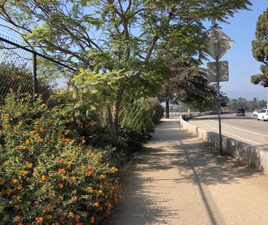
Silver Lake Reservoir Trail
Hours: Sunrise to sunset
Dogs: Dog Friendly
Parking: You can find street parking in the residential area.
Bathroom: There are no public restrooms.
What makes the Silver Lake trail stand out from the rest is that this is really more of a walking trail than a hiking trail. It is also an urban trail so it doesn’t quite give you the same experience as when you are on other trails in Los Angeles County. However, it can still be a nice place for a good workout, and it is dog friendly. If you want more of a challenge with your walk you can opt for the stairs when you get to the steeper part of the trail. Most of the path is paved but there are parts of the path where it becomes a dirt trail.
Angeles National Forest
View this post on Instagram
Hours: Open 24 hours
Dogs: While on a trail or in/around the campgrounds & picnic area dogs must be kept on a leash no longer than six feet.
Parking: $5 entry or $30 annually. The Adventure Pass can be purchased at most major LA sporting goods stores like Big 5 and REI.
Bathroom: I am sure they have bathrooms at the visitor center, but little information is available about bathrooms here.
With over 200 trails to choose from, you are bound to find a fun trail to hike in the Angeles National Forest. Be sure to check for any road closures before you go as winder conditions, rock slides or fires can prevent you from getting to the trails. You won’t have a cell signal for most of your time in this area so be sure to use caution. Previously, I shared some secret swings that you can find in the Angeles National Forest in this post.
Mount Baldy
View this post on Instagram
Hours: 6am – 11:00pm
Dogs: Dog Friendly
Parking: No parking fee. Parking is easier to find the earlier you arrive.
Bathrooms: Primitive bathrooms at the trailhead.
This is part of the Six Pack of Peaks. Hiking Mount Baldy is not for beginner hikers. This is a strenuous trail.
Even on a hot day, it can be chilly by the time you reach the summit so plan accordingly. Head to Mt. Baldy Lodge after. The trail is 11 miles long, the highest elevation is 10,064 ft. The official name is Mt San Antonia but it’s called Mt Baldy for the bald face of the Baldy Bowl. This is part of the Angeles National Forest. This is not a hike that should be done throughout the year as it can get very dangerous in the snow. The Mt Baldy trailhead is rough 1 hour and 15 minutes east of DTLA. Put the Manker Campground in your GPS.
There are two popular trails for Mt. Baldy. The Baldy Bowl/Devil’s Backbone Trail or the tougher option which is the Bear Canyon Trail. Hiking poles can be handy for this hike. This is one of the hikes where it is extra important that you do plenty of research ahead of time so that you don’t find yourself getting lost.
Topanga State Park – Temescal Trail
View this post on Instagram
Hours: 8 am – 6:30 pm
Dogs: Dogs are not allowed on the trails.
Parking: $12 for parking, you can use a card or cash. If you arrive early you might be able to find free street parking on Temescal Canyon Road across from the park.
Bathroom: There are bathrooms but they are described by visitors as disgusting. I would recommend finding a bathroom outside of the park for before & after.
Topanga State Park is the largest state park within a city limit n the US. The Temescal Trail is a 3.8-mile loop trail near the Pacific Palisades. Hikers recommend going counterclockwise in order to see the ocean as you walk down.
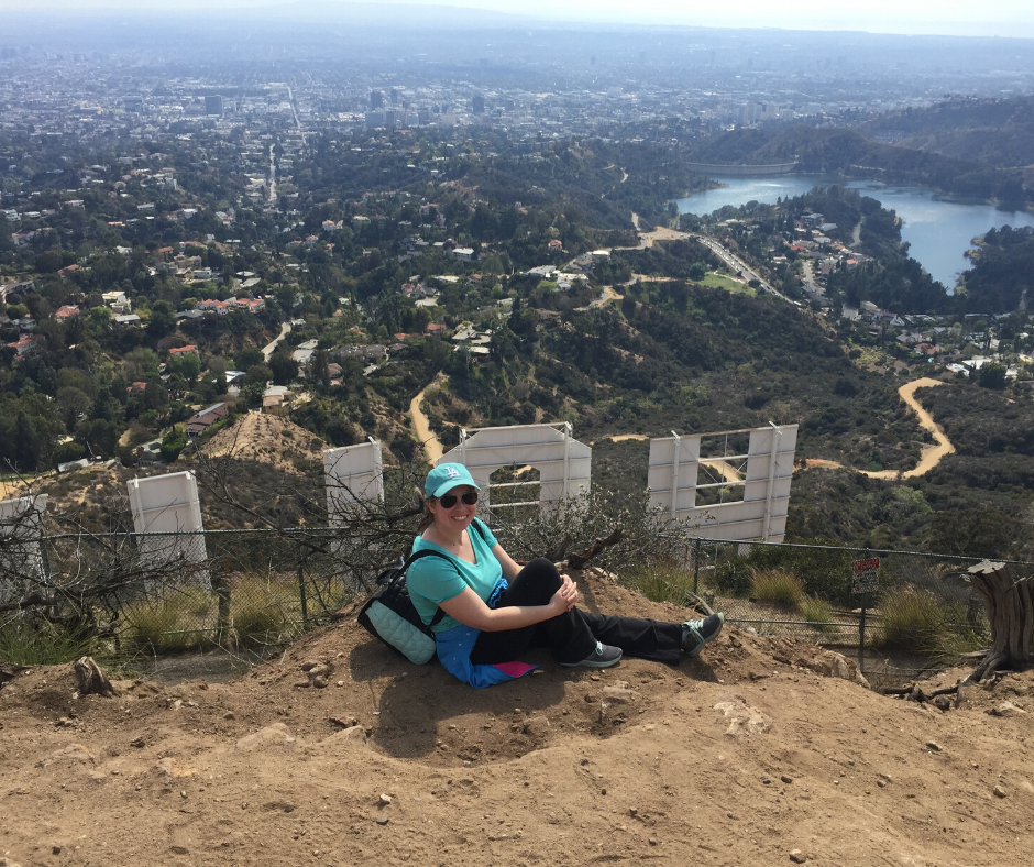
The Hollywood Sign
Hours: Sunrise to Sunset
Dogs: Dog Friendly
Parking: For the most part you won’t have to pay for parking. However, should you choose to start hiking from the top parking lot of the Griffith Observatory you would then need to pay $15+ for parking.
Bathroom: If you pass the observatory you can use restrooms in that area but you won’t find any on the trails.
Hiking to the Hollywood sign is a must-do. There are so many hiking trails to the Hollywood Sign that it can be challenging to pick the one that is right for you. The first time I tried hiking to the sign I went up the Burbank Peak trail towards Wisdom Tree and planned to hike to the sign from there. However, this hike was more difficult than I anticipated so I did not make it to the sign. I was then encouraged by a co-worker to park near the Bronson Canyon Caves used in the Batman TV series. I hiked here first, which was really fun, and then continued on to the Brush Canyon trail to get to the back of the sign. You can choose to either go towards the front of the sign or go to the top behind it. You cannot go directly to the sign.
In her article, Ellie wrote about the Hollyridge tail. You can take other hiking trails to the Hollywood Sign like Innsdale Drive, and the Hollywood Reservoir Loop, there’s also a Griffith Observatory Hike that can lead you to the sign. I know other bloggers who like parking near Lake Hollywood Park, a great place to picnic. They then walk up from the park into the neighborhood look for Mulholland & Deronda and go through the gate. This will lead to a picturesque spot for photos with the front of the sign.
I have also done the Captain’s Roost hike which doesn’t get you too close to the sign but it still makes for some great photos.
Other hikes that I have blogged about are Eaton Canyon, Pumpkin Rock, Runyon Canyon, and the Burbank Peak Trail.